KSL Studio 5 Utah National Parks Bucket List
Ideas for Visiting the National Parks at Spring Break

Spring Break is upon us in Utah, which means road trip season to southern Utah with the national parks as favorite destinations.
Recommendations for Utah’s Mighty Five National Parks
Here is a short list of places we recommend visiting at Utah’s national parks. This isn’t a complete list but if you could only visit one or two places, we think this list is worth adding to plans.
Be Prepared
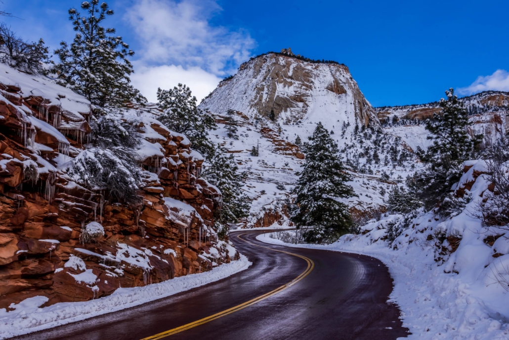
With all the snow we’ve received this winter in Utah and throughout the west, popular spring break destinations may not be quite the same as travelers are accustomed to. Planning accordingly will be important to assure a successful trip. Southwest Utah is currently at 227 percent of normal snowfall, the most in the state. Many of the traditional playgrounds for spring break could still be under snow.

Utah’s Mighty Five National Parks
Here are a few recommendations for hiking trails and other things to do.
Utah’s most popular park for visitors from out of state is also the most popular park for locals. Here are some of the places we recommend visiting we think should be high on your list.
- Angels Landing – A permit is now required to hike the last section leading to Angels Landing that begins at Scout Lookout. The trail to Scout Lookout begins at the Grotto shuttle stop. Click here to read about one of our experiences on Angels Landing with suggestions, tips and video of our adventure.
- The Narrows – This is Zion’s most popular trail that anyone can hike when conditions are allowable. The trail begins at the end of the Riverside Walk from Temple of Sinawava shuttle stop. The park closes The Narrows section when the Virgin River is flowing at 150 cfs (cubic feet per second) or higher. We expect this to be the case through the early weeks of summer considering the amount of snow in this year’s snowpack. Click here to read our trip through The Narrows with Tim Hughes and his family.
- Big Bend to Weeping Rock – There is a little-known trail in the main canyon between the Big Bend and Weeping Rock shuttle stops. It follows the Virgin River below the road and offers some of the best views of Angels Landing, the Great White Throne, Cable Mountain, and Organ Rock. The trail can be taken in either direction, we’ve marked the trailheads on the map below. The descent on the Big Bend side requires a bit of scrambling, nothing serious.
Eastside of Zion
- Observation Point – The trailhead for Observation Point from Zion Canyon has been closed since the Cable Mountain landslide of 2019. However, the trail is accessible from on top near Zion Ponderosa Ranch. (See map) We recommend checking conditions of the dirt road to the trailhead prior to making the trip. Out and back is approximately 6.5 miles with some undulation, but nothing as strenuous as the trail from the canyon. we think this trail offers the best view of Zion Canyon.
- Canyon Overlook – Located on the east entrance to the Zion Tunnel, the trailhead is just a few steps from the ranger shack. Parking is very limited and often a challenge. There is a small lot across from the ranger’s shack and another down the road a short distance on the north side. We recommend going early before the late morning crowd arrives. We recommend this for all hikes in the main section of the park. The hike is approximately 1.5 miles out and back and require climbing steps and has some exposure along the trail. The payoff is the jaw-dropping view at the end of the canyon below and surrounding cliffs. We make it a point to take our tour groups of all ages on this trail.
- Many Pools – Located .8 mile east the shorter second tunnel on the east side of the park. Look for the trailhead with a small turnout parking lot and restrooms. The trailhead is 400 feet north of the parking area on the north side of the road. You have to really look for where you drop down to the bottom below the road. The many sandstone pockets in the rock fill with water with snow melt or when raining, which cascades to the bottom. Click here to read about our experience at Many Pools.
- Recommendation – If you would like to experience another side of Zion and avoid the crowds in the busy season in the main canyon, we suggest visiting the east side where there are many opportunities in and near the park for canyoneering, Jeep adventures, horseback riding and more. Visit East Zion Adventures | Utah Jeep Tours, Canyoneering & More
Kolob Terrace
- Northgate Peaks – Located in the Kolob Terrace section of the park, which is accessible by a long hike from the West Rim trail from Zion Canyon or by paved road near the Town of Virgin. This 4-mile out and back trail is one of our favorites. The views at the end looking toward West Temple are breathtaking. If you climb to one of the higher points (strenuous) the 360-degree views are some of the best in the park. Here’s an article about what of our experiences at North Gate Peaks.
- Hop Valley Trail – The Hop Valley Trail is located in the Kolob Terrace wilderness area of Zion National Park. This is not a classic trail like those found in Zion Canyon. It’s a primitive route that connects the upper Kolob Terrace section with La Verkin Creek trail in lower section of Kolob Canyons. Once you reach La Verkin Creek you can continue on by following the trail to Kolob Arch. The distance from the trailhead to LaVerkin Creek is approximately 6.5 miles, we logged just over 14 miles round-trip with added wandering.
Kolob Canyons
- Zion National Park’s Kolob Canyons is located on the far northwest tip of the park next to Interstate-15 south of the New Harmony exit. There is a separate visitors center located here where entrance fees can be paid that are valid for any fee area in the park. There is a five-mile road in this section that ends in a circular parking lot that offers panoramic views of the finger canyons of Kolob. It’s also the trailhead for the 1-mile hike (out and back) on the Timbercreek Overlook Trail (easy). There are several other trails located alone the lower stretches of the road including the Middle Fork of Taylor Creek (5 miles out and back), La Verkin Creek to Kolob Arch (14 miles out and back), and South Fork of Taylor Creek (3 miles out and back). We’ve hiked all these trails and enjoy them all. See map below.
This is just a short list of trails we enjoy at Zion National Park, for more trail information and general information on Zion click here where you can find helpful links for shuttle information, Angels Landing permits, river conditions, and more.
Zion National Park Information Guide (nps.gov)
ALERTS & RECOMMENDATIONS
Drainage Improvement Project at Zion South Entrance
Zion began work in early-winter 2021 to improve a number of drains under the road near the park’s south entrance. This work is meant to make it less likely that we will experience flooding like that we saw in June 2021.
In order to get the work done as quickly as possible, there is one lane open going into the park and one lane open going out of the park. Especially during spring break, there are sometimes lines at the park’s south vehicle entrance station. Since the Zion Canyon Shuttle System began seasonal operations on March 11, visitors can avoid lines of cars by parking in the Town of Springdale and riding the Springdale Line to the park’s pedestrian and bicycle entrance.
You’ll find public domain photos of the work over the last few weeks in this album: Zion Drainage Improvement
The Narrows
After getting into the park, one of the most popular attractions is the Narrows. At this time of year, it’s important to plan ahead because high water can affect access. In past years when we’ve seen this significant winter and spring precipitation, it has affected water flow in the Virgin River through the Narrows. We share information about past years on our website, and we work with the US Geological Survey to get up to date information about current flow so that we can share it with visitors.
We share regular updates on our website, social media, at park visitor centers, and person-to-person from rangers to visitors at trailheads and on trails.
Know before you go! Check the forecast, dress in layers, drink and carry plenty of water, and have a plan…and a back-up plan. There are lots of great things to do in Zion, and we encourage you to use the tools we offer to plan your visit.
We share information online on our current conditions’ webpage, on our Narrows webpage, and through our partners at the US Geological Survey and National Weather Service.
The Narrows – Zion National Park (U.S. National Park Service) (nps.gov)
Current Conditions – Zion National Park (U.S. National Park Service) (nps.gov)
North Fork Virgin River Near Springdale, UT – USGS Water Data for the Nation
7-Day Forecast 37.53N 112.66W (weather.gov)
Kolob Canyons
Due to road damage that coincided with rain over the last couple of weeks, the Kolob Canyons Road is closed at the Kolob Canyons Visitor Center. This closure applies to all visitors including drivers, hikers, and bikers. The National Park Service is monitoring conditions on the road and assessing options to reopen it.
You can read more about work on that road and Zion Canyon Scenic Drive (work there involves a closed lane but not a road closure) in this news release: Zion National Park maintenance staff respond to road damage – Zion National Park (U.S. National Park Service) (nps.gov)
Bryce Canyon National Park isn’t as well known for its hiking trails like Zion or Capitol Reef, but there are a few amazing trails along the rim and into the amphitheater that take hikers through the Hoodoos giving a different look and perspective of the park.
Bryce is a buffet of scenic viewpoints! This is definitely a photographer’s park, as are all Utah’s parks, but Bryce stands out as being very different than the rest. Here are a few suggestions when visiting the park. We also wrote several articles on Bryce with additional suggestions and recommendations that we’ll reference at the end.
- Bryce Point – Of all the viewpoints this one is best for seeing sunrise. On one occasion while guiding a tour we ran into an IMAX crew filming sunrise from Bryce Point for a national park movie. This validated what we already knew. Sunsets are not as spectacular as sunrise but the best point for sunset is actually at Sunset Point, how ironic is that? Bryce Point is also the beginning or ending point for the Pee-A-Boo Trail the intersects with the Navajo Loop trail that begins and ends at Sunset Point. Starting at Bryce Point is much easier since it reduces the amount of uphill hiking. Bryce point is the highest viewpoint in the Bryce Canyon Amphitheater section of the park. Another tip about the Peek-A-Boo Trail is that there are two routes to this trail, one for humans and one for horses; you’ll know which is which very quickly!
- Queens Garden Trail – This is our favorite trail to taking guests below the rim into the amphitheater between Sunset and Sunrise Points. (Bryce Canyon is actually an amphitheater, not a canyon.) We like to start at Sunset Point and end at Sunrise since the trail isn’t quite as steep leading to Sunrise; however, the uphill climb is a bit longer. Round-trip distance is approximately 3.5 miles. Here’s an inspiring story about an experience we had on the Queens Garden Trail from a few years ago about two young men we met through the KSL Outdoors Show. Nature’s Great – People Can Be Even Greater! – ROADTRIPPINwithBobandMark
We have written several articles on Bryce Canyon that include recommendations on how to visit in a day, points of interest, etc. Click on the following links to learn more.
Bryce Canyon Winter Trip 2023 – ROADTRIPPINwithBobandMark
Bryce Canyon in a Day – ROADTRIPPINwithBobandMark
Bryce Canyon Winter Sunrise – ROADTRIPPINwithBobandMark
Mossy Cave – Bryce Canyon National Park – ROADTRIPPINwithBobandMark
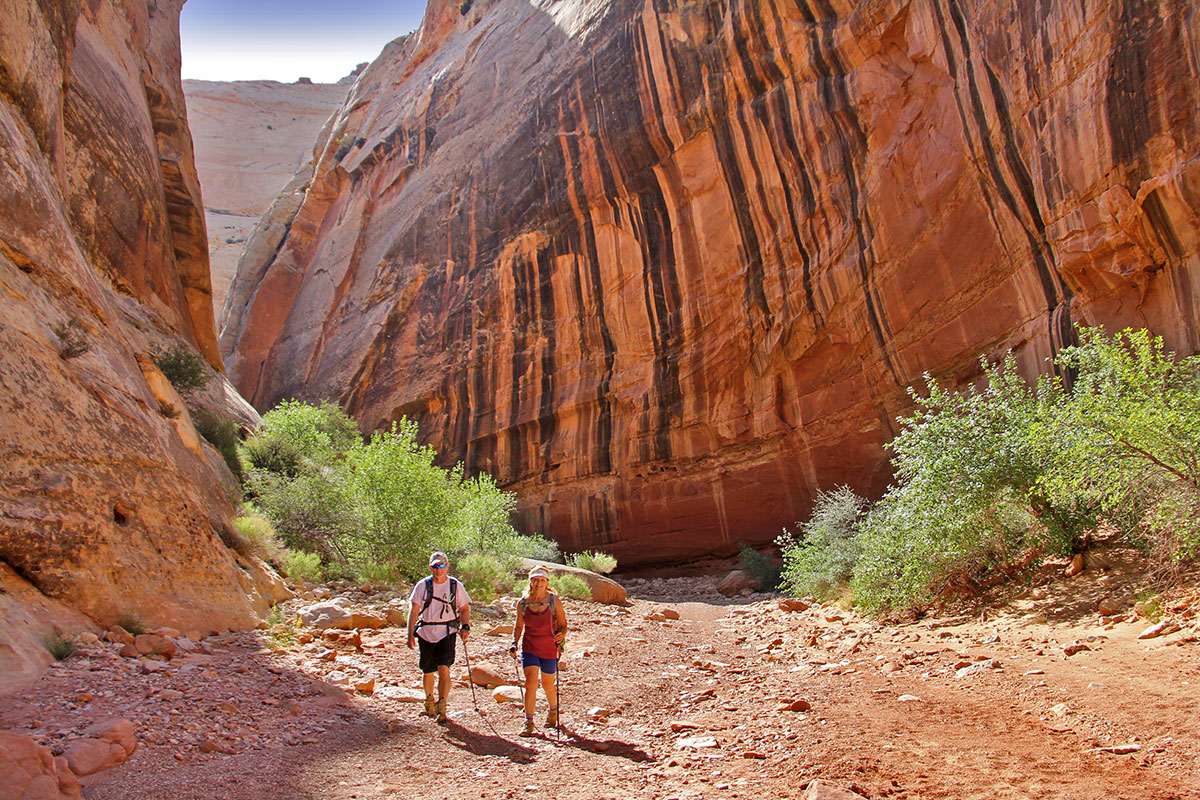
Capitol Reef National Park is the ultimate hiking park with trails for all levels and interests. The majority of the park is backcountry accessible by dirt and gravel graded roads, and only two paved roads located in the main section of the park.
In this article we’ll focus on hikes in the main section of the park accessible from the paved roads. A few of the more popular trails include Grand Wash, Chimney Rock, Cohab Canyon, and Hickman Bridge. If you drive through Capitol Gorge at the end of Scenic Drive, Pioneer Register is another trail you can take.
Points of Interests Along SR-24
Points of interest and scenic views worth visiting on or near SR-24 include Panorama Point, Goosenecks Overlook, Sunset Point, Fruita Schoolhouse, Fremont Petroglyph Panel, Navajo Dome scenic viewpoint, and Behunin Cabin.
Grand Wash and Hickman Bridge
Grand Wash – The trailhead is located 1.5 miles from the Behunin Cabin on the left. This hike will give you the experience of walking in a canyon among towering canyon walls. You can walk the full length one-way of approximately three miles or go just a short distance.
Hickman Natural Bridge – This two-mile out and back trail is an ideal family hike, which is considered moderate. Because this is such a popular hike the parking lot fills quickly, overflow parking is along the shoulder of the road. Restrooms are available in the main parking lot.
Canyonlands Island in the Sky
The Canyonlands Island in the Sky visitor center is located 30 miles from Moab on SR-313. Near the visitor center is a view worth seeing. From the visitor center walk across the road and hike down to the rim where you’ll be treated with spectacular views of the Shafer Trail and canyon below, La Sal Mountains to the east and Dead Horse Point. There is high exposure and no rails for those who might be squeamish of heights.
Mesa Arch is a short relatively easy half-mile (1 mile out and back) hike to the rim where the arch is located. If the parking lot is full, I keep going and stop here on the way back. I never pass it up if there’s an available spot.
Upheavel Dome is a moderate 1.5 miles out and back hike to a site that is believed to be either a meteor impact crater or salt dome.
Grand View is the last stop on the road, as far as it goes. There is a short walk to the main viewing area with 1.8 miles out and back trail you can take. The views from here are, Grand! Just beyond this point, out of view, is the confluence of the Colorado and Green Rivers. It’s approximately 45 miles to Moab from here.
Beginning last year, Arches National Park implemented a new system requiring a reservation for visiting the park from April 1 to October 31. Here is a link to learn more about the system and how to book a reservation.
If you are planning a hike to Delicate Arch, try to book an early reservation if hiking in the hotter months. The hike generally takes 1.5 -2 hours. If you are not hiking to Delicate Arch, you can still see it from the lower parking lot from a distance. This will require less time and the parking lot isn’t as busy.
Double Arch, North and South Windows and Turret Arch. Allow 1.5 hours here, which is plenty of time to walk the trails and see the arches. This is the section of the park that was used in the movie, Indiana Jones and the Last Crusade.


Leave a Reply
Want to join the discussion?Feel free to contribute!