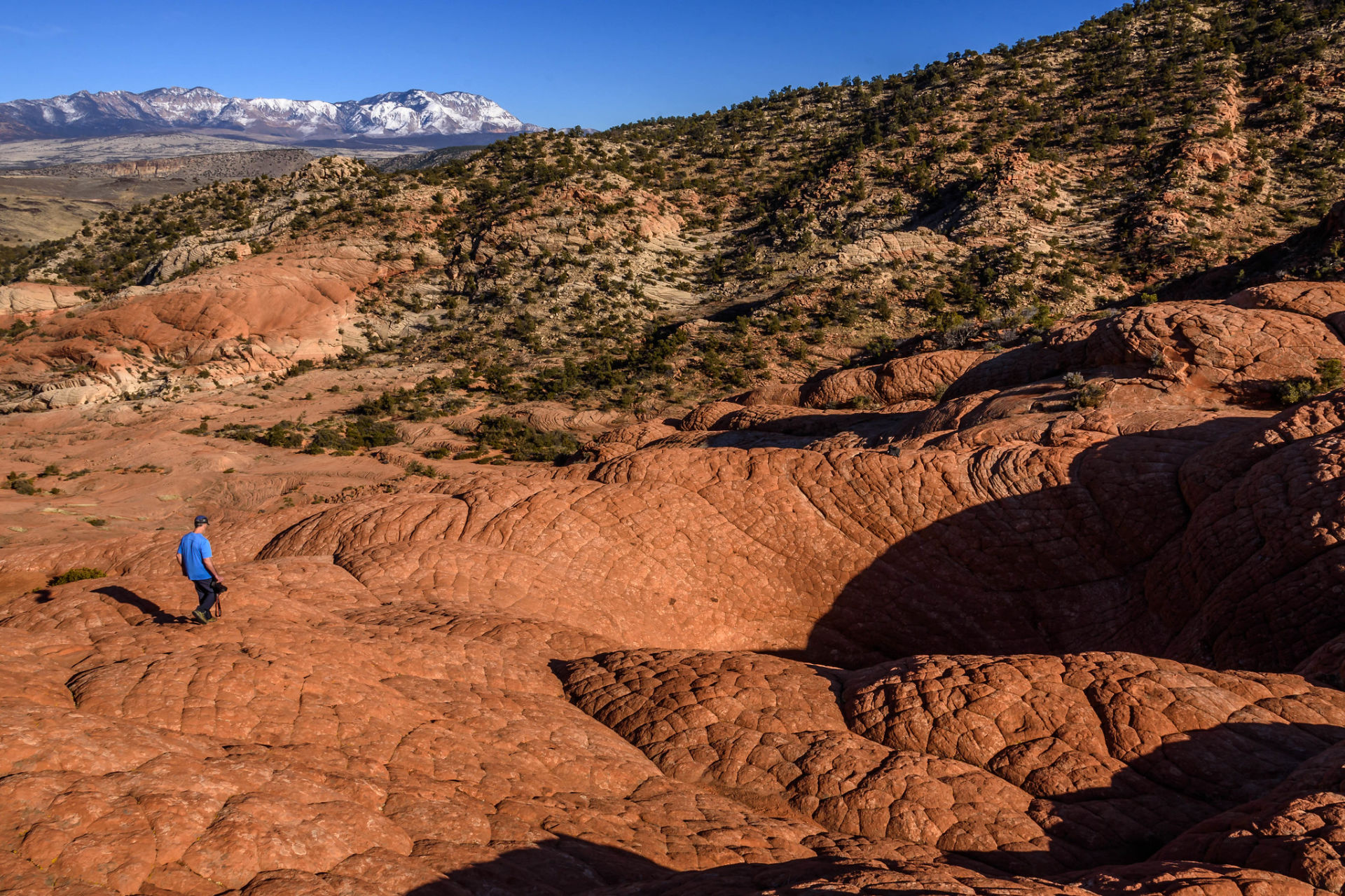
We chose a beautiful January afternoon to explore The Vortex, also known as the Bowl by many of the locals, that is hidden away in a nondescript hilly area near Gunlock Utah, about 30 minutes from downtown St. George. This is one of the many hidden gems that are mostly known by locals that sit just minutes off the beaten trail. This is typical for southwest Utah that is best known for its iconic Zion National Park, state parks and recreation areas.
The trail leading to The Vortex is not obvious and can be a bit difficult to find if it’s your first time. There are many “mini trails” that all seem to funnel to where you ultimately want to be with an occasional cairn that vaguely lead to the Vortex site. We ended up taking a different route back that took us farther east of where we started but it was easy to find the trailhead where we started.
Slightly more than 2 miles out and back, the route to the Vortex is on a variety of trail surfaces from rocky terrain at the beginning, soft sand in the middle, and sandstone (slickrock) at the end. Large petrified dunes are the predominant formation with washes cutting through sandstone and lava rock. For those who are familiar with Yant Flat, the surrounding terrain of cross-bedded sandstone often referred to as elephant skin, resembles the landscape of the Red Cliffs National Conservation Area between Washington and Silver Reef.
Large petrified dunes are the predominant formation with washes cutting through sandstone and lava rock.
The Vortex is located at the top of a high sandstone ridge west of the trail. On the day we visited, it was empty of water, however, a smaller nearby water pocket was full. I would estimate the Vortex is 25 feet deep, very steep, and shaped like a funnel. We climbed down to the bottom and found that it is easier to follow the natural spiraling line of the stratified rock rather that scooting straight down. Our exit strategy was to get a head of steam using momentum to push us up the same route we used coming down.
Our views from the top offered sweeping vistas of the surrounding landscape, gorges, and valleys with the town of Gunlock within our view. We took some time to explore the area and wanted to stay longer but daylight was quickly fading.
The hike is moderate and suitable for most. There are exposed cliffs in the area but nothing in the immediate area surrounding the Vortex, you can stay away from these areas. We would take our grandchildren on this hike, many hikers take their pets from the evidence of tracks along the trail. Allow at least two hours for this hike out and back but you’ll probably want to stay longer.
Getting there From St. George take Old Highway 91 through Santa Clara past Gunlock State Park to Lower Sand Cove Road. There will be a sign marking the turn. From the turn it is 2.9 miles on a dirt road to the parking area and trailhead. MAP
What to bring Daypacks for water, snacks, sunscreen, and camera is sufficient. Wear comfortable, sturdy shoes. You will be exposed to the sun throughout this hike. Hat, ample water, and sunscreen are highly recommended.
Best time to go Fall through Spring
Trailhead: Trail head is located near the lower sand cove reservoir.
Difficulty: Moderate
Distance & elevation gain: 2.3 miles out and back, 524 ft elevation gain.
Trail type: Out and back with varied terrain including lava rock, soft sand, sandstone.
Time required: 1.5 – 2 hrs
Dogs: Allowed on leash
Fees: None
Seasonality: Year-round; Fall, Winter, and Spring are best time to visit.
Bathroom: No restrooms
Water: No water filling stations


Leave a Reply
Want to join the discussion?Feel free to contribute!