A Grand Adventure: A Trip to Whitmore Canyon Overlook
The Grand Canyon
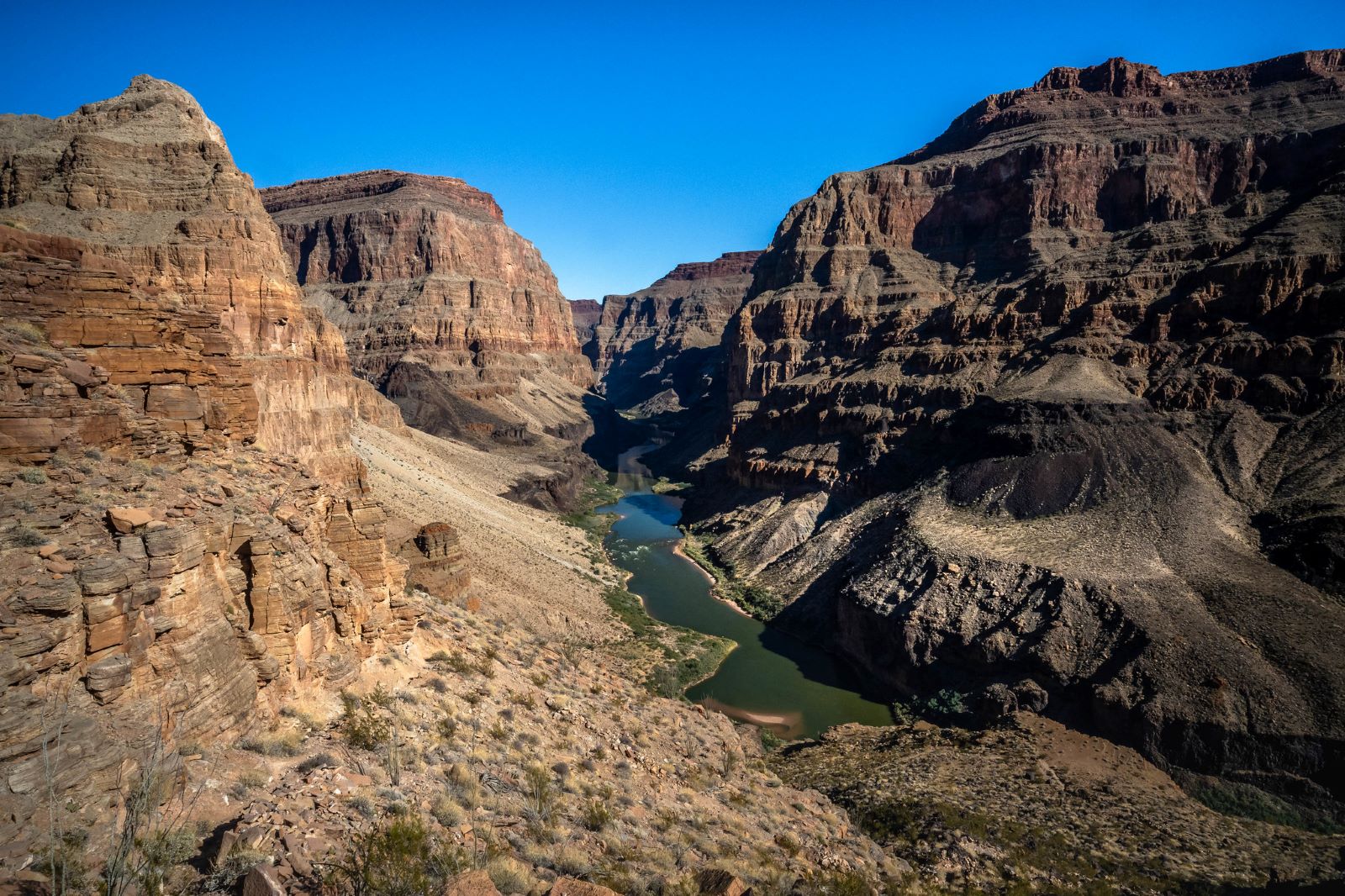
The Grand Canyon, who hasn’t heard of this natural wonder, one of world’s seven natural wonders. Photographs, as hard as we try, cannot translate its immensity and beauty. John Wesly Powell, the first person to explore the 27o plus river miles of the canyon in 1869 described it as the “great unknown,” and a “wonderful and terrible,” place. There is much to be said about the canyon, its beauty, and of its wild and untamed primitive areas, which today still exist. We’ve only scratched the surface in our exploration of the canyon.
Grand Canyon Parashant National Monument
There are many places in and around the Grand Canyon to explore beyond the paved tourist destinations of the North and South rims. These places are accessible only by back roads that generally require four-wheel drive high clearance vehicles. One of these places is Whitmore Canyon a place most people have never heard of located in the Grand Canyon Parashant National Monument. From our understanding, Parashant is a Paiute family name meaning large deer or elk standing in the water.
Located on the northwest side of the canyon not that far from where I live in southern Utah, Whitmore Canyon is south of St. George Utah on the north side of the Colorado River just outside of the Grand Canyon National Park boundaries.
This past week my longtime adventure friend, Bill Murphy, and I ventured out to Whitmore Canyon Overlook located in the Grand Canyon-Parashant National Monument, a remote and rugged area that is managed by the National Park Service and the Bureau of Land Management.
Our Journey to Whitmore Canyon
Go Prepared
To get to Whitmore Canyon Overlook from St. George, a high-clearance 4×4 vehicle with off-road tires is recommended. Additionally, you will need a map, a GPS, and a full tank of gas, as there are no services or cell phone coverage along the way. We took my satellite phone from Skycall Satellite and a spare can of gas just in case. Click here to get updated information on road conditions.
Fasten Your Seatbelts
The drive to the overlook is an adventure in and of itself. The most direct route begins at the River Road exit on Southern Parkway in St. George. The overlook is about 73 miles but takes more than three hours to get there because of the diverse terrain and rough roads. The first 60 miles of the route are on a good dirt road that is usually suitable for all high-clearance 4×4 vehicles with many parts of the drive reminding me of the wash boarded road to Hole in the Rock in the Grand Staircase Escalante National Monument.
The last 10 miles are very rough and rocky, as the road crosses an ancient lava flow. This section requires careful driving and low speed, as the sharp basalt rocks can damage your tires and your vehicle. You might also encounter some steep and narrow sections, so be prepared to use your 4×4 skills.
The last 10 miles wind down a lava flow that ends with spectacular views of the Grand Canyon and Colorado River. The last section of road is pretty rough and rocky that will test your suspension. This section requires careful driving and low speed, as the sharp basalt rocks can damage your tires and your vehicle. However, the journey is well worth it, as you will see some amazing scenery and experience some thrilling off-road driving. This is a great road for OHV machines!
Mount Trumbull Schoolhouse
About 50 miles into the drive, you’ll come to a junction where the Mount Trumbull Historical Schoolhouse is located. Built in 1922 and used until 1966, the schoolhouse served the early homesteaders and ranchers that named the area Mount Trumbull after the nearby mountain to the east. The small one-room building functioned as a school, church, dance hall, and a town meeting place. Folks from miles around would come to dance, listen to music and socialize.
Exploring the Overlook
Once you reach Whitmore Canyon Overlook, you will be rewarded with a stunning view of the Grand Canyon and the Colorado River below. Surrounded by Barrel Cacti in Mojave Desert landscape the overlook is about 1,000 feet above the river where you can see Whitmore Canyon, the Whitmore Rapids, and Lava Falls. Grand Canyon National Park is on the other side of the river that requires a permit to visit the area.
You can explore the overlook by hiking, biking, or driving along the rim. There are two spurs off NPS-1263 that lead to different viewpoints: one to the east and one to the west. The east spur is about 0.5 miles long and ends at a rocky outcrop that offers a panoramic view of the canyon and the river. The west spur is about 0.3 miles long and ends at a grassy meadow that offers a closer view of the Whitmore Rapids and Lava Falls. You can also hike down to the river from the west spur on a steep and strenuous trail. Bring plenty of water and snacks and be aware of the weather and wildlife namely snakes while hiking in the craggy rocks.
Whitmore Canyon Trail
The Whitmore Canyon Trail is a 1.6-mile round-trip hike descends from the inner rim of the Grand Canyon to the Colorado River with about 900 ft. of elevation change, passing through a fascinating landscape of lava flows, and basalt columns.
The hike is considered moderately challenging that takes on average just over an hour to complete. The trail is a moderately steep and rocky, but the views are spectacular and worth every step.
The trail ends at the riverbank, where a sign marks the boundary of the Grand Canyon National Park. This is where river rafters are flown out by helicopter to the Bar 10 Ranch at the end of a multi-day trip from Lees Ferry. It’s also the beginning of a much shorter trip to Lake Mead. In 2014 we were flown out from this point, Whitmore Wash, after enjoying seven days on the river.
Be sure to take water and snacks; wear sunscreen and a hat since there is no shade along the route.
Camping & Lodging
Bar 10 Ranch
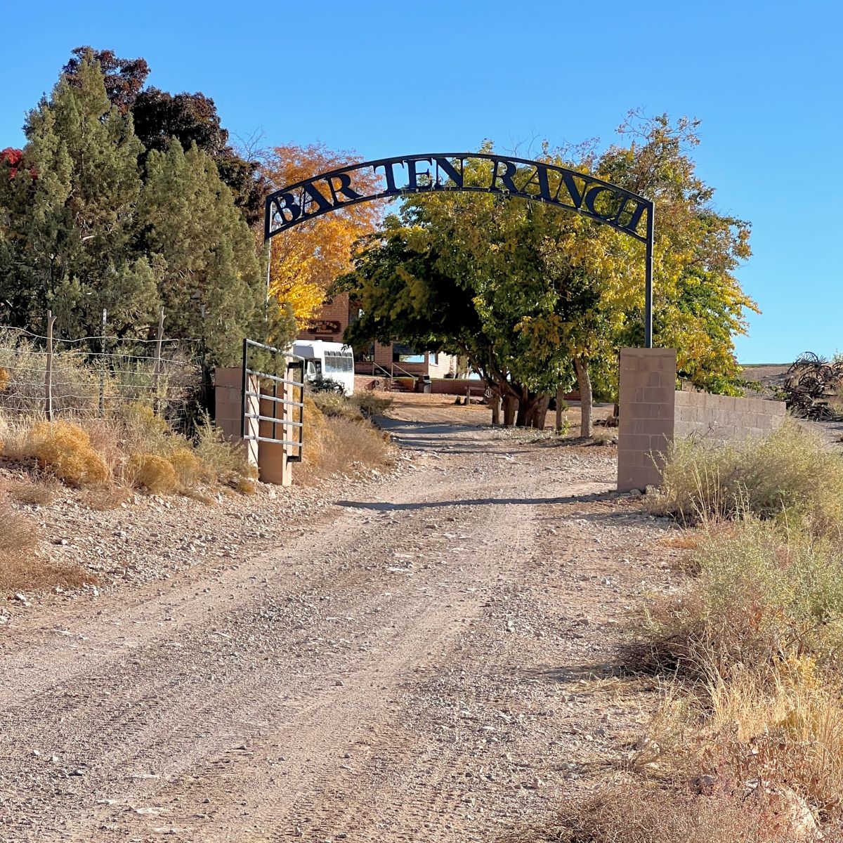
You can stay at the Bar 10 Ranch, which is a private ranch that offers lodging, meals, and activities. The ranch is located about 10 miles before the overlook on BLM-1045. You will need to make a reservation in advance and pay a fee to stay at the ranch. You can also use the ranch as a base to explore the area, as they offer guided tours, ATV rentals, horseback riding, and helicopter rides. Click here for more information.
Camping
You can camp at the Fumarole Campground, which is located about 5 miles before the overlook on NPS-1263. The campground has 5 sites, each with a picnic table and a fire ring. There are no fees, no reservations, and no amenities. The campground is open year-round, but access might be limited by snow or mud in the winter.
You can camp at the Whitmore Point, which is a sheltered area at the end of NPS-1263 that is somewhat protected from the wind. There are no designated sites, but you can find some flat spots to pitch your tent. There are no fees, no reservations, and no amenities. The area is open year-round, but access might be limited by snow or mud in the winter.
Final Thoughts
Visiting Whitmore Canyon Overlook was a great adventure in the primitive area of the Grand Canyon Parashant National Monument. We plan on coming back in the spring when the Barrel Cacti are in bloom and camp out to so we can capture its beauty during the best light of dusk and dawn. I’m sure we’ll also have an amazing night sky for our gazing pleasure. There is so much more to explore that we simply didn’t have time to do on a day trip in November. For more information about the Parashant National Monument CLICK HERE.


Leave a Reply
Want to join the discussion?Feel free to contribute!