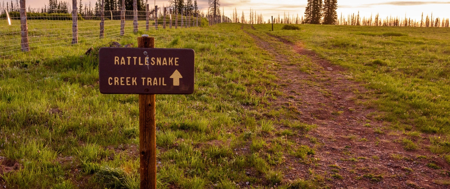
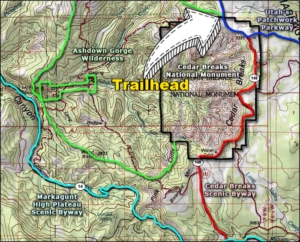
When the weather gets toasty in St. George, we head to the high country. For us that often means a trip to the Markagunt Plateau east of Cedar City, also known as Cedar Mountain. This is where Brian Head, Cedar Breaks National Monument, and Duck Creek Village are located. Our destination this day was the top of Rattlesnake Creek Trail located on Hwy 143 between Cedar Breaks National Monument and Brian Head Peak.
During the hottest months, the temperature in the upper elevations of the plateau can be 20-25 degrees cooler than the valley’s below, and 25-30 degrees lower than St. George and Zion National Park. Only 90 minutes from home it’s our go-to place to escape the heat and for winter adventures.
Rattlesnake Creek Trail is located in the Ashdown Gorge Wilderness Area that borders the north and west boundaries of Cedar Breaks National Monument. The trail is 9.5 miles one way and descends 3,400 feet through through forests of firs, pines and aspen where snow often lingers well in to the summer in the shadows and north facing slopes. Near the top of the trail there are a couple of short side trails that offer great views of Cedar Breaks that are marked on the map below.
The upper trailhead is located on highway 143 south of the turn-off for Brian Head Peak and north of the north view of Cedar Breaks National Monument. A turn-out with parking and trail signs is easily seen on the west side of the road. The lower trailhead is located at the landslide area on highway 14 between mile markers 7 and 8. If you want to hike the full length I recommend leaving a car at one end and hike from the other. I recommend starting at the top. We went out and back from the top, the walk back to the top is long and strenuous.
Difficulty: Moderate to strenuous depending on direction you take. Non-technical, high altitude (top is 10,400 ft).
Distance: 9.5 miles one-way
Elevation gain: 3,448 ft.
Trail type: Singletrack dirt trail / out and back
Multi-use: Hiking, nature walks
Dogs: On leash
Seasonality: Spring, Summer, Fall (snow can begin early and end late at this elevation)
Bathroom: None
Camping – Camping is permitted only within the national forest section of the trail, and excellent campsites can be found where Ashdown Creek and Rattlesnake Creek meet.
* The last 3.4 miles of the hike involve walking in a narrow canyon creek at the bottom of Ashdown Gorge. Wear sturdy, waterproof hiking shoes. Heavy spring runoff generally lasts well into June, waters can run dangerously high, swift, and cold in early summer with sporadic flash flooding throughout the summer monsoon season. Assess weather conditions and check for flash flood warnings before hiking this trail.


Leave a Reply
Want to join the discussion?Feel free to contribute!