

WHERE IS AURORA UTAH?
Good question, but perhaps a better question might be, why should Aurora Utah be included on your list of places to explore?
Located 150 miles south of Salt Lake City and 175 miles north of St. George, Aurora is in the heart of central Utah near Interstate-70 where northern Utah meets its southern half. The two sides converge in a wonderland of trails from hiking and mountains biking to horseback riding and off-roading. We’re here to explore the topside of the Paiute and Gooseberry OHV trails.
Settled in 1875, this small town of just under 1,000 people didn’t officially become a city until 1982. Like most other small towns in Utah and particularly in this region, Aurora has a quiet, rural pace of life where the residents are vested in the land and have a love for their surroundings.

Off-Roading Hub
Located at the top of the Paiute Trail, Aurora is one of only two cities situated right on Route One of the Paiute ATV Trail system, the other is the nearby town of Salina, both in Sevier County. With off-roading as one of Utah’s largest segments of outdoor recreation the community wants to capitalize on their unique location on the trail and position the town as a hub to the hundreds of miles of nearby OHV (off highway vehicle) trails to attract more riders to the area.
Trailhead
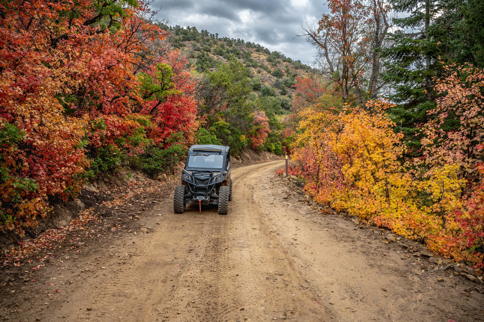
Our adventure began by meeting our guides at the West Park Paiute Trailhead in Aurora. West Park is the brainchild of the community in developing more OHV friendly facilities for riders. Restrooms aren’t currently available at West Park but are in the plan. There is a large gravel lot with ample parking for groups.
The community is looking to improve anything in Aurora that can add to a rider’s experience. Opportunities to get a little more infrastructure, add restrooms and solar lights at the West Park to make it more inviting to come to Aurora.

Off-Road Adventure
Our guides for the day were the town mayor and a city councilman, who are spearheading the effort to develop OHV infrastructure in Aurora. Since we had only one day, we decided to split up so we could shoot photography of two primary trails. Mark went with the mayor on the Gooseberry Trail located in the Manti-La Sal National Forest and Bob went with the city councilman on the Paiute Trail in the Fishlake National Forest.
Sevier County where Aurora is located is quickly becoming known for its numerous trails. You can ride every day of the week, and somewhere different each day. This is true not just for off-roading, but for biking, hiking, and horseback riding. The majority of these trails are in the surrounding mountains and forests.
Off-Road Adventure
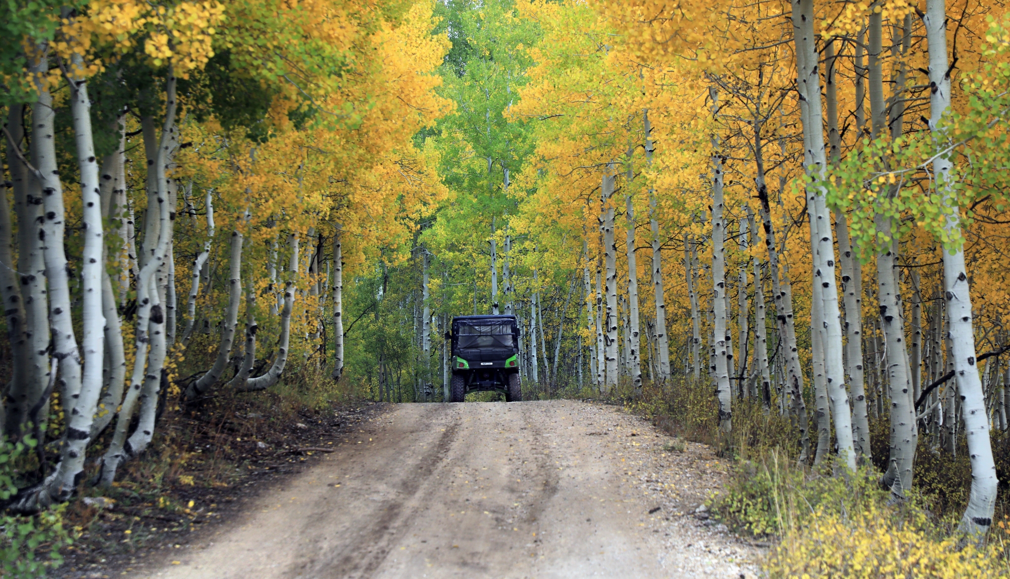
Many of the routes we rode in this trail system run along the tops of the mountains offering spectacular views one after another. On this northern stretch of the Paiute Trail, you can go nearly to Scipio to the north and Beaver to the south, all from Aurora.
The Paiute Trail system is massive covering nearly a thousand miles with Aurora as one of the key starting points. There are places you can get to from Aurora that are off the beaten path where you won’t see crowds of other off-road machines.
The main Paiute 01 trail leaving Aurora to the west going up on the Pahvant range in the Fishlake National Forest. Upon reaching the top of the range you can ride north about 11 miles to Coffee peak and the end of the road. On this trail you pass Mt Catherine, Pioneer, Jacks, and Coffee peaks that are all over 10,000 ft.

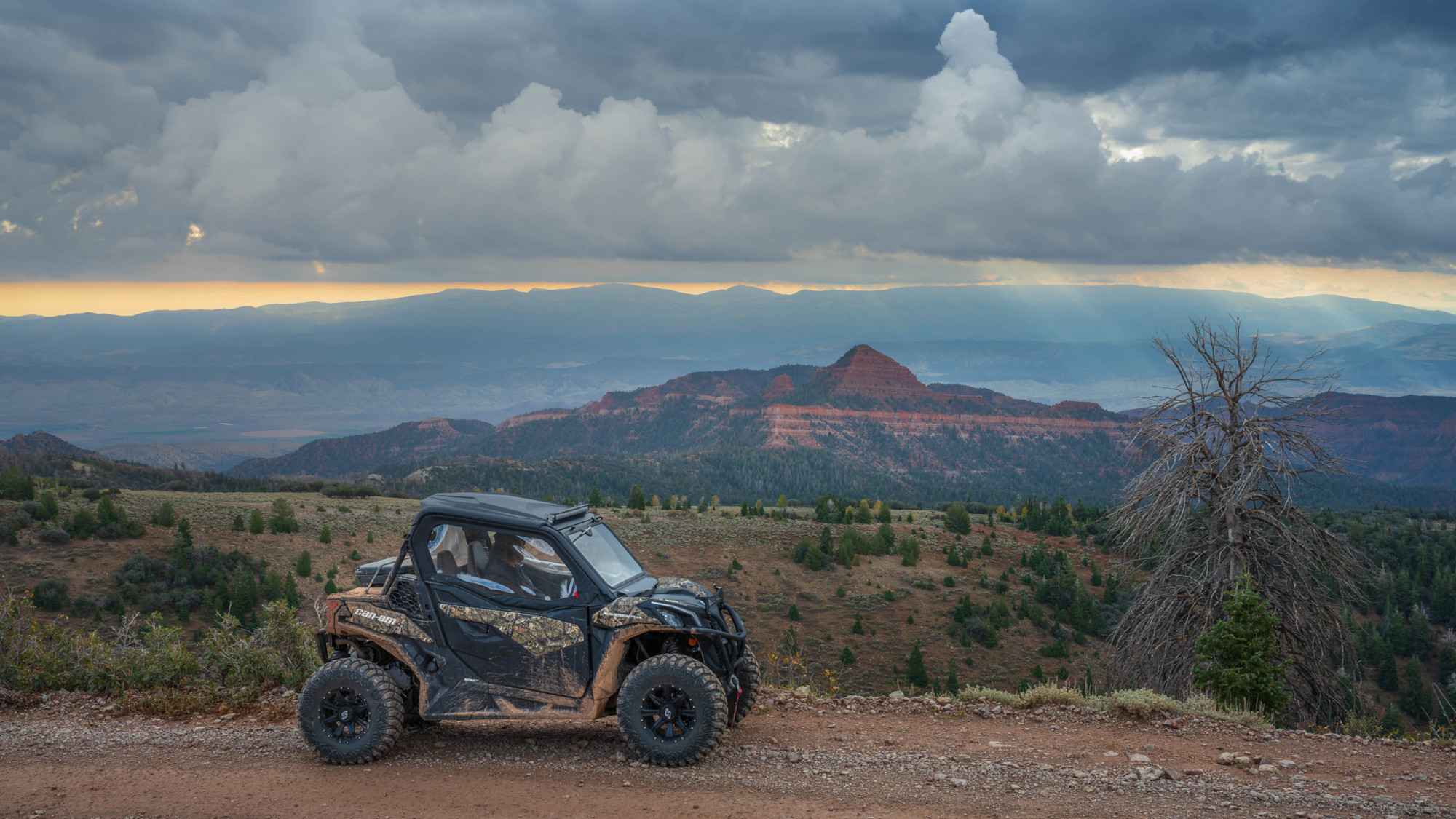
To the south you can take in about a 250-degree view of red rock Beehive peak that is a bit over 9000 ft. To the south the 01 trail has many side trails that go to most towns along the route we took the road toward Fillmore.
You can also go to Kanosh Richfield Elsinore Joseph and drop into the Fremont Indian state park off the 01 Paiute route. From different vantage points you can see most communities in Millard, Sevier and even Sanpete counties.
On really clear days looking to the west, you can see Wheeler Peak at over 13,000 ft in the Great Basin NP in Nevada some 120 miles away. I’m not really sure how far we went that day, but the guy, I forgot he name that does all the mapping for these things could probably give you all the mileages to different destinations.
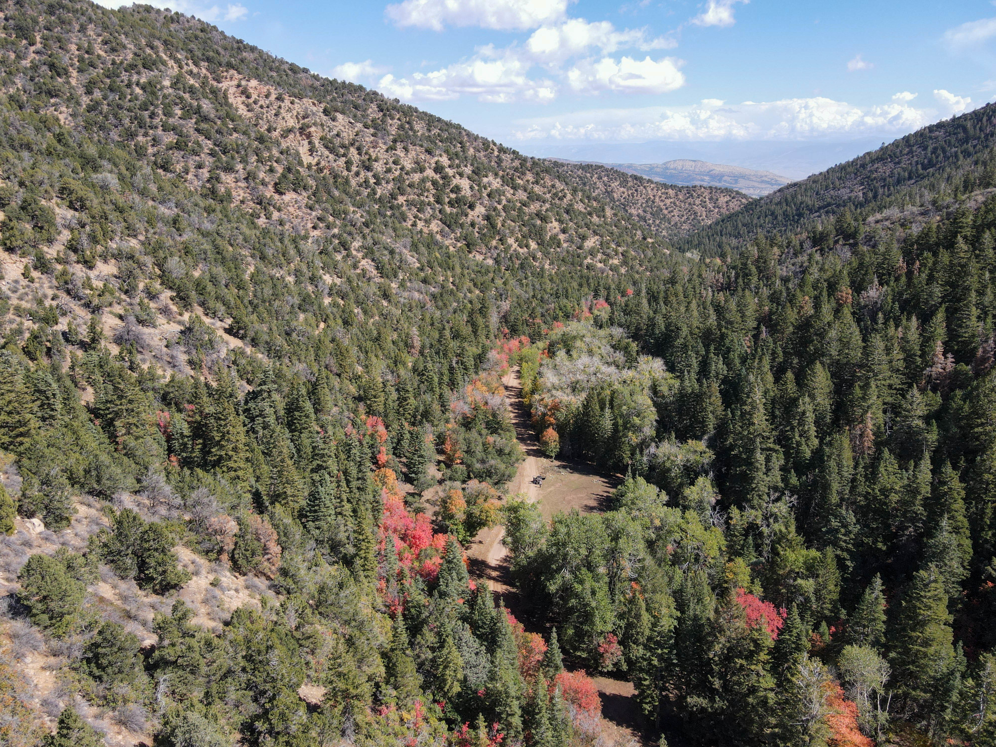
There are hundreds of miles of trails of all types east and west of Aurora including hiking, biking, and horse trails. Many of these trails are multi-use while others are designed more specifically for a particular user group. The Pahvant Mountains separate Aurora from Fillmore to the west with the Wasatch Plateau on the east.
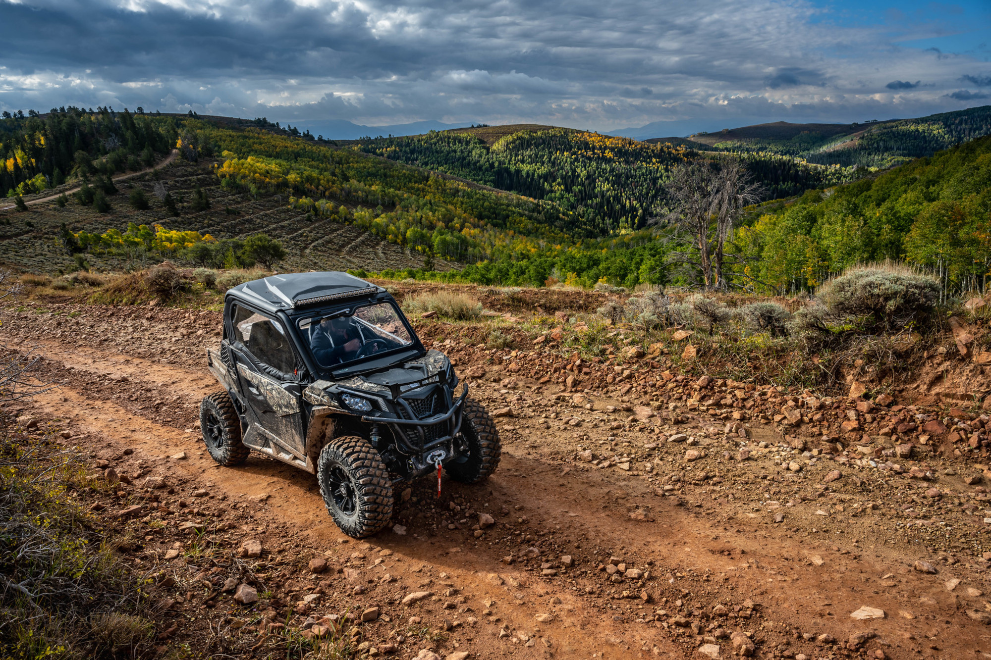
The mountainous terrain surrounding Aurora could be described as “pastural.” Large sweeping stands of Aspen and forests of pines are separated by sprawling grassy meadows. From the highest mountain peaks to the lowest forest valleys these trails have a bit of everything and then some.
With the monsoon rain storms this year and cool mountain temperatures, the trails showed off their magnificent beauty with fields of wildflowers which lasted through a good part of the summer.
Even on “crowded” days this is some of the most remote riding in the state and as a result, even with the beautiful scenery, you’ll be lucky to see another vehicle in the same area all day.
The nearest services for lodging and eating are in Salina located five miles to the east and Richfield 14 miles to the southwest. You can find these services on the county’s website.


Leave a Reply
Want to join the discussion?Feel free to contribute!